ST. GEORGE — The National Weather Service in Salt Lake City has issued a hazardous weather outlook starting Sunday for various portions of Southern Utah.
The outlook is forecasting high temperatures and thunderstorms into midweek, which could lead to flash flooding in certain areas, especially slot canyons.
In addition to the hazardous weather outlook for Southern Utah, a flash flood warning is currently in affect in Arizona for northeastern Mohave County, just below the Utah-Arizona state line. Flooding in central Arizona has already led to several deaths when torrential flood waters poured into a popular swimming hole.
Read more: Flash flood at swimming hole kills 7; more people missing
Locally, the National Weather Service warned on Wednesday that rain over the Brian Head Fire scar could lead to dangerous debris flows consisting of rock, mud, vegetation and other loose materials.
Hazardous Weather Outlook affected area
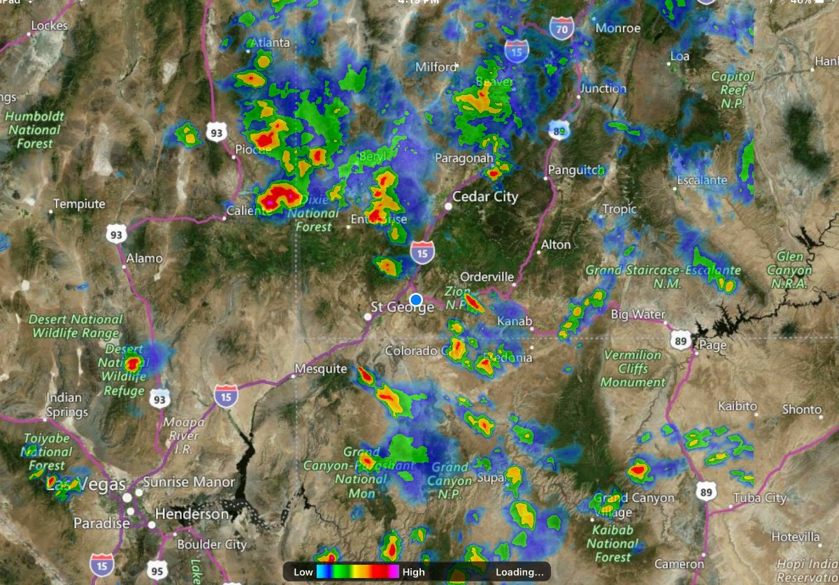
The hazardous weather outlook affects the western two-thirds of Utah.
Regionally affected areas include west-central Utah, southwest Utah, Utah’s Dixie, Zion National Park, south-central Utah, Glen Canyon Recreation Area/Lake Powell and central and southern mountains.
Timing
Isolated to scattered showers and thunderstorms will develop mainly over areas of higher terrain Sunday evening. These showers and thunderstorms may produce brief gusty winds and brief heavy rain.
Hot temperatures are expected in many valleys with a moderate risk for those sensitive to heat.
Stormy conditions continue into midweek
Isolated to scattered showers and thunderstorms will develop each afternoon and evening through Tuesday.
The potential for showers and thunderstorms will increase again across the outlook area around midweek.
Flash flooding, debris flows
“Turn around, don’t drown” when encountering flooded roads. Most flood deaths occur in vehicles.
Remain alert for flooding even in locations not receiving rain. Dry washes, streams and rivers can become flooded with raging killer currents in a matter of minutes, even from distant rainfall.
People in the warning area are advised move to higher ground immediately. Residents living along streams and creeks should take immediate precautions to protect life and property.
If a debris flow has occurred, it is important to realize that the runout area remains very dangerous. Additional debris flows may occur within minutes of the original flow. Please remain vigilant and be prepared to take swift action.
Resources
Email: [email protected]
Twitter: @STGnews
Copyright St. George News, SaintGeorgeUtah.com LLC, 2017, all rights reserved.