SOUTHERN UTAH — The National Weather Service has issued a “Red Flag Warning” for much of Washington, Kane and Iron counties for dry thunderstorms and gusty outflow winds. This is a critical fire conditions alert and is in effect from noon to midnight Wednesday.
Affected area
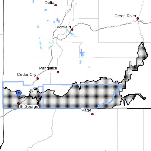
Fire weather zones 497 and 498 (see map insert), which include the Mojave Desert and the Grand Staircase areas respectively.
Thunderstorms
High based thunderstorms will develop over the higher terrain and drift over the valleys Wednesday afternoon and evening. Frequent dry lightning is possible.
Outflow winds
Erratic wind gusts in excess of 45 mph are possible in and around any thunderstorms.
Impacts
The combination of dry lightning, low humidity and gusty outflow winds after the recent extended dry period will increase the likelihood of wildfire starts.
Precautionary/ preparedness actions
A “Red Flag Warning” means that critical fire weather conditions are either occurring now or will shortly.
A combination of strong winds, low relative humidity and warm temperatures can contribute to extreme fire behavior.
Related posts
- Fireworks banned in most areas, 2014 restrictions guide
- Top 5 fireworks shows and more; where to watch
- Fire restrictions expanding across southwest Utah, northwest Arizona
Email: [email protected]
Twitter: @STGnews